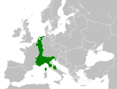
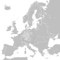
Fájl:Electorate of Bavaria 1789.svg

Eredeti fájl (SVG fájl, névlegesen 450 × 456 képpont, fájlméret: 928 KB)
|
Ez a fájl a Wikimedia Commonsból származik. Az alább látható leírás az ottani dokumentációjának másolata. A Commons projekt szabad licencű kép- és multimédiatár. Segíts te is az építésében! |
Összefoglaló
Licenc
- A következőket teheted a művel:
- megoszthatod – szabadon másolhatod, terjesztheted, bemutathatod és előadhatod a művet
- feldolgozhatod – származékos műveket hozhatsz létre
- Az alábbi feltételekkel:
- Nevezd meg! – A szerzőt megfelelően fel kell tüntetned, hivatkozást kell létrehoznod a licencre és jelezned kell, ha a művön változtatást hajtottál végre. Ezt bármilyen észszerű módon megteheted, kivéve oly módon, ami azt sugallná hogy a jogosult támogat téged vagy a felhasználásod körülményeit.
- Így add tovább! – Ha megváltoztatod, átalakítod, feldolgozod ezt a művet, a közreműködésedet csak az eredetivel megegyező vagy hasonló licenc alatt terjesztheted.
Eredeti feltöltési napló
This image is a derivative work of the following images:
- File:Europe_1789.svg licensed with Cc-by-sa-3.0
- 2013-04-14T03:44:26Z Alphathon 450x456 (858577 Bytes) Corrected some errors in northern Italy
- 2013-04-14T01:38:01Z Alphathon 450x456 (853881 Bytes) tweaked again
- 2013-04-14T01:36:10Z Alphathon 450x456 (853881 Bytes) Tweaked Holy Roman Empire border style
- 2013-04-14T01:33:26Z Alphathon 450x456 (853857 Bytes) == {{int:filedesc}} == {{Information |Description={{en|A blank Map of Europe circa 1789. This map also includes a border for the [[:en:Holy Roman Empire|Holy Roman Empire]]. Since there are so many small German states, they h
Uploaded with derivativeFX
Képaláírások
A fájl által ábrázolt elemek
mű tárgya
14. április 2013
Fájltörténet
Kattints egy időpontra, hogy a fájl akkori állapotát láthasd.
| Dátum/idő | Bélyegkép | Felbontás | Feltöltő | Megjegyzés | |
|---|---|---|---|---|---|
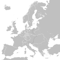
| aktuális | 2021. október 17., 08:48 |  | 450 × 456 (928 KB) | Fenn-O-maniC | Fixed the Russo-Swedish border to match the Treaty of Åbo of 1743 |
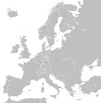
| 2013. április 18., 20:26 |  | 450 × 456 (948 KB) | Alphathon | Various fixes and style change | |
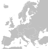
| 2013. április 18., 15:41 |  | 450 × 456 (849 KB) | Alphathon | Fixed Scandinavian borders | |
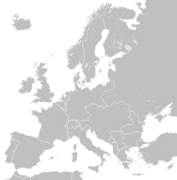
| 2013. április 14., 17:00 |  | 450 × 456 (834 KB) | Alphathon | == {{int:filedesc}} == {{Information |Description={{en|A map of the Electorate of Bavaria circa 1789.}}{{de|Eine Landkarte das Kurfürstentum Bayern c. 1789.}} |Source={{Derived from|Europe_17... |
Fájlhasználat
Az alábbi lap használja ezt a fájlt:
Globális fájlhasználat
A következő wikik használják ezt a fájlt:
- Használata itt: bg.wiki.x.io
- Használata itt: lt.wiki.x.io
- Használata itt: ru.wiki.x.io
Metaadatok
Ez a kép járulékos adatokat tartalmaz, amelyek feltehetően a kép létrehozásához használt digitális fényképezőgép vagy lapolvasó beállításairól adnak tájékoztatást. Ha a képet az eredetihez képest módosították, ezen adatok eltérhetnek a kép tényleges jellemzőitől.
| Rövid cím | A map of Bavaria within the Holy Roman Empire and Europe ca. 1789 |
|---|---|
| Kép címe | A map of the Electorate of Bavaria within the Holy Roman Empire, and within Europe, circa 1789. This map is licensed under the Creative Commons Attribution-Share Alike 3.0 Unported license (https://creativecommons.org/licenses/by-sa/3.0/) by the wikimedia user "Alphathon" (http://commons.wikimedia.org/wiki/User:Alphathon), and is based upon "Blank map of Europe.svg" (http://commons.wikimedia.org/wiki/File:Blank_map_of_Europe.svg), the details of which follow:
A blank Map of Europe. Every country has an id which is its ISO-3166-1-ALPHA2 code in lower case. Members of the EU have a class="eu", countries in europe (which I found turkey to be but russia not) have a class="europe". Certain countries are further subdivided the United Kingdom has gb-gbn for Great Britain and gb-nir for Northern Ireland. Russia is divided into ru-kgd for the Kaliningrad Oblast and ru-main for the Main body of Russia. There is the additional grouping #xb for the "British Islands" (the UK with its Crown Dependencies - Jersey, Guernsey and the Isle of Man) Contributors. Original Image: (http://commons.wikimedia.org/wiki/Image:Europe_countries.svg) Júlio Reis (http://commons.wikimedia.org/wiki/User:Tintazul). Recolouring and tagging with country codes: Marian "maix" Sigler (http://commons.wikimedia.org/wiki/User:Maix) Improved geographical features: http://commons.wikimedia.org/wiki/User:W!B: Updated to reflect dissolution of Serbia & Montenegro: http://commons.wikimedia.org/wiki/User:Zirland Updated to include British Crown Dependencies as seperate entities and regroup them as "British Islands", with some simplifications to the XML and CSS: James Hardy (http://commons.wikimedia.org/wiki/User:MrWeeble) Validated (http://commons.wikimedia.org/wiki/User:CarolSpears) Changed the country code of Serbia to RS per http://en.wiki.x.io/wiki/Serbian_country_codes and the file http://www.iso.org/iso/iso3166_en_code_lists.txt (http://commons.wikimedia.org/wiki/User:TimothyBourke) Uploaded on behalf of User:Checkit, direct complaints to him plox: 'Moved countries out of the "outlines" group, removed "outlines" style class, remove separate style information for Russia' (http://commons.wikimedia.org/wiki/User:Collard) Updated various coastlines and boarders and added various islands not previously shown (details follow). Added Kosovo and Northern Cyprus as disputed territories. Moved major lakes to their own object and added more. List of updated boarders/coastlines: British Isles (+ added Isle of Wight, Skye, various smaller islands), the Netherlands, Germany, Czech Republic, Denmark, Sweden, Finland, Poland, Kaliningrad Oblast of the Russian Federation (and minor tweaks to Lithuania), Ukraine, Moldova (minor), Romania, Bulgaria, Turkey, Greece, F.Y.R. Macedonia, Serbia, Bosnia and Herzegovina, Montenegro, Albania, Croatia, Italy (mainland and Sicily), Malta (http://commons.wikimedia.org/wiki/User:Alphathon). Added Bornholm (http://commons.wikimedia.org/wiki/User:Heb) Released under CreativeCommons Attribution ShareAlike (http://creativecommons.org/licenses/by-sa/2.5/). |
| Szélesség | 450 |
| Magasság | 456 |

