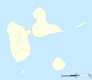
„Fájl:Guadeloupe department location map.svg” globális használata
This page shows where a file is used on other wikis. You can also find that information at the bottom of the file description page.

Használata itt: af.wiki.x.io
Használata itt: als.wiki.x.io
Használata itt: an.wiki.x.io
Használata itt: ar.wiki.x.io
Használata itt: ast.wiki.x.io
Használata itt: be-tarask.wiki.x.io
Használata itt: be.wiki.x.io
Használata itt: bg.wiki.x.io
Használata itt: bs.wiki.x.io
Használata itt: ca.wiki.x.io
Használata itt: ceb.wiki.x.io
- Plantilya:Location map Guadeloupe
- Old Fort Point
- North Point
- Mont Saint-Jean
- Bombo
- Piton Island
- Whale Rock
- Baleine
- Moule
- Sugarloaf
- Le Pain de Sucre
- Les Saintes
- La Tortue
- La Baleine (pagklaro)
- Grande Pointe
- Ferry Point
- Saint Peter Island
- Sugarloaf Passage
- Portland Bay
- Cemetery Point
- Massacre Hill
- Pointe Noire
- Passe du Sud
- Petite Passe
- Morne Rouge
- Soufriere
- Salee River
- Pointe Mahaut
- L’Ilet
- Pointe des Salines
- Pointe Rouge
- Pointe Percée
- Pointe du Cimetière
- Porte d’Enfer