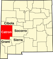
„Fájl:Map of New Mexico highlighting Catron County.svg” globális használata
This page shows where a file is used on other wikis. You can also find that information at the bottom of the file description page.

Használata itt: ar.wiki.x.io
Használata itt: bar.wiki.x.io
Használata itt: bg.wiki.x.io
Használata itt: bpy.wiki.x.io
Használata itt: cdo.wiki.x.io
Használata itt: ceb.wiki.x.io
Használata itt: ce.wiki.x.io
Használata itt: cy.wiki.x.io
Használata itt: de.wiki.x.io
- Acoma Pueblo (Indianerreservat)
- Catron County
- Datil (New Mexico)
- Mogollon (New Mexico)
- Vorlage:Navigationsleiste Orte im Catron County
Használata itt: en.wiki.x.io
- List of counties in New Mexico
- Catron County, New Mexico
- Reserve, New Mexico
- Aragon, New Mexico
- Datil, New Mexico
- Acoma Indian Reservation
- Pie Town, New Mexico
- Lost Adams Diggings
- Luna, New Mexico
- Mogollon, New Mexico
- Alma, New Mexico
- Glenwood, New Mexico
- San Francisco Plaza, New Mexico
- Quemado, New Mexico
- Apache Creek, New Mexico
- Cruzville, New Mexico
- Old Horse Springs, New Mexico
- Cooney, New Mexico
- Clairmont, New Mexico
- Pleasanton, New Mexico
- Red Hill, New Mexico
- Template:Catron County, New Mexico
- User:Nyttend/County templates/NM
- Category:Populated places in Catron County, New Mexico
- National Register of Historic Places listings in Catron County, New Mexico
- Escudilla Bonita, New Mexico
- Homestead, New Mexico
- Lower Frisco, New Mexico
- Middle Frisco, New Mexico
- Rancho Grande, New Mexico
- Rivers, New Mexico
- Mangas, New Mexico
- Patterson, New Mexico
- Greens Gap, New Mexico
- User:AridCeption/sandbox
- File talk:Map of New Mexico highlighting Catron County.svg